A novel method for predicting the population density of the critically endangered North Atlantic right whale has been published for periods 2003-2009 and 2010-2020.
Declining populations
A highly sought after species for the whaling industry in the late 1800s, the Northern Atlantic right whale was thought to have a population less than 100 individuals in 1935 which slowly recovered in the 1900s before suffering further losses from predominately human caused injuries. In recent years, 125 whales have died or been seriously injured, mostly from entanglements in fishing gear and being struck by vessels in both U.S. and Canadian waters.
Changes in migration patterns, driven by shifts in prey availability due to climate change, have exposed right whales to new risks, such as gear entanglements and vessel strikes. Despite increased sightings in certain areas like southern New England, a significant portion of the population remains unaccounted for in summer, likely foraging in unprotected locations. These challenges have led to reduced reproductive success, body condition, and overall health of the population. To address these issues, a detailed understanding of the whales’ distribution throughout the year is crucial for assessing and mitigating risks.
New research using 17 years of available visual cetacean survey data up to 2020 was applied to newly updated Density Surface Models method analyses regional density changes, estimates prediction uncertainty, and validates predictions using Passive Acoustic Monitoring (PAM) detections. Researchers published their findings in an open access article in Marine Ecology Progress Series.
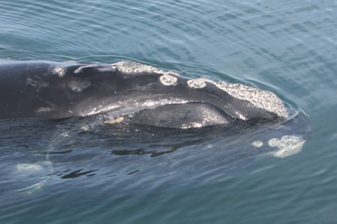
Credit: Florida Fish and Wildlife Conservation Commission
Combined survey effort
The collaborating surveys covered over 2.9 million km of line-transect survey effort, comprising over 9.7 million km2 of effective effort (roughly the same size as the USA). The surveys sighted 4,439 groups, comprising 13,565 individuals, with 99%of sightings coming from aerial surveys. This information was coupled with auditory data from almost 500 hydrophone recorders in US Atlantic waters that captured whales’ calls. Lining up visual and acoustic datasets for the first time, researchers built a statistical model to estimate the number of whales per square kilometer at different points in time.
“The more accurate and detailed the mapping, the better chance we have to save dwindling numbers of right whales from preventable injury and fatality,” said Patrick Halpin, director of Duke’s Marine Geospatial Ecology Lab.
The statistical model is a revision of a 2016 model that predicts whale density from environmental data, like sea surface temperature. This latest version incorporates new data to reflect whales’ changing migration and feeding patterns, including their presence in new areas that lack protection measures for marine life.
“With nearly three times more aerial survey data than we had before, and confirming evidence from the hydrophones, we were able to show how strongly the population has shifted its distribution,” said Jason Roberts, a Duke research associate and lead author of the study.
Right whales maintain the health and balance of marine environments and the entire food web through their feeding habits. As climate change has reduced the population of their prey, whale migration patterns have become more unpredictable, increasing the chances that human activities, like commercial fishing, may harm whale health and chances of reproduction.
Using maps obtained by satellite ocean monitoring, or from physical ocean models like the recently published one, researchers can more accurately predict whale density across the U.S. east coast.
Mitigating risk
The National Marine Fisheries Service, known as NOAA Fisheries, a federal agency within the National Oceanic and Atmospheric Administration, uses this model to assess and mitigate risks to large whales posed by activities such as trap and pot fishing, vessel traffic, naval testing and training, and offshore energy activities.
This research supports NOAA Fisheries’ overarching North Atlantic Right Whale Road to Recovery, which describes the agency’s efforts to address threats to the species, and monitor recovery progress. In the United States, the Marine Mammal Protection Act prohibits intentional harming or disturbance (known as “takes”) of marine mammals by human activity, and limits takes that happen incidentally.
Read the Duke University’s press release here.
Read the open access article here.