Seismometers could detect flooding and offer real-time information about incoming floods and their parameters.
Normally, seismometers are used to pick up information from earthquakes. But increasingly, researchers are looking at using them for different additional purposes. For flooding, this could be a game changer.
Climate change is making extreme weather more likely, and extreme weather upstream is often linked to flooding downstream.
Devastating floods in Germany
This became obvious in 2021 in many parts of central and western Europe. Parts of Germany, for instance, witnessed virtually unprecedented floods. Communities in Germany’s Ahr Valley, for instance, were left devastated by a flood that killed almost 200 people and destroyed or damaged hundreds of homes. The floodwaters were so strong that they even destroyed three stations used to measure water levels along the Ahr river, rendering them useless and leaving the community blindfolded as to what was coming their way. But a nearby seismic station, that picks up vibrations from earthquakes, still detected the flood.
Seismic stations basically detect vibrations and ground motion. It doesn’t necessarily have to be an earthquake — seismic stations can also detect large bombs, for instance, which is why they’re even used as a way to monitor any potential nuclear bomb testing activity. They can also detect things like landslides or sinkholes. So Michael Dietze, a postdoctoral researcher at the University of Göttingen, had an idea: what if they could also pick up the vibrations from floods?
When a flood comes downstream, it can destroy most things in its path, but a seismometer doesn’t have to be close to pick up vibrations. It can pick up large earthquakes from hundreds or thousands of kilometers away, and in the case of the Ahr Valley, a seismometer was 1.5 km away. By looking at the data from the seismometer, Dietze and colleagues were able to measure the “seismic footprint” of the flood, and from it derive information about its magnitude, velocity, and trajectory in real-time — information that would have been very valuable during the 2021 floods. “If the data stream from that station had been available and analysed as our research now shows, essential real time information on the magnitude and velocity of the flood would have been available,” says Dietze.
Since this information can be derived in almost real-time, this type of system could be used to improve flood risk assessment and management not just in Europe, but in any region that is prone to flooding and has seismometers — and given the large network of seismic stations all around the world, plenty of regions could benefit from it.
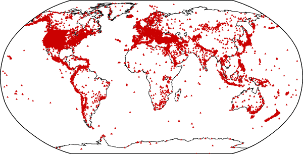
A (probably incomplete) map of seismic stations from around the world.
Of course, having access to more seismic stations (especially in close proximity to flood-prone areas), could provide even more detailed information about this, and could do so at a tiny fraction of the cost incurred by the 2021 disaster, which was in the tens of billions of euros.
“Which water level is to be expected? Which parts of settlements are likely to be inundated? How much debris does the flood transport? How fast does the water flow? Where is the flood front at a given time? The precision and resolution of answers to these questions would increase significantly with the number of available seismic stations in a catchment,” the researchers conclude in the study.
The full story can be read in ZMEscience here.