New mapping tools from the Environment Agency and Natural England which reveal the extent of seagrass and saltmarsh habitats around England for the first time, are now live.
The maps will provide valuable information for the management of these crucial blue carbon habitats, helping to drive forward restoration projects.
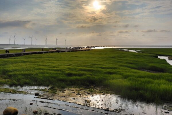
In a release from Government, the Environment Agency said: Saltmarsh and seagrass habitats are vital to support ocean recovery and fight the impacts of climate change by protecting important marine biodiversity and capturing and storing carbon. They provide a wealth of benefits for people and wildlife, including acting as a flood defence, improving water quality, and providing a place for recreation. They are also key habitats for breeding and feeding birds, many of them migratory, as well as nursery sites for a range of commercial fish and marine invertebrate species.
To help protect and expand these habitats, the Environment Agency recently published its saltmarsh inventory and accompanying report, mapping where saltmarsh has been gained and lost over a ten year period. The data revealed a 7% increase in saltmarsh extent around the English coast. This takes the total habitat to over 350km squared, with saltmarsh restoration projects contributing 37% of this gain.
A brand new national seagrass map has also been published which identifies where intertidal and subtidal seagrass habitats have been surveyed in England and draws on historic data to reveal how seagrass extent has changed over time.
Roger Proudfoot, Estuaries and Coasts Planning Manager at the Environment Agency, said:
These new maps help us understand the threats to these important habitats, providing a baseline for seagrass and showing how saltmarshes are changing which helps inform us on actions we can take to protect and restore them.
Both saltmarsh and seagrass are an important part of the Environment Agency’s work to tackle climate change and the biodiversity crisis; improve water quality; and in promoting green growth for a sustainable future.
A number of coastal habitat restoration schemes are already underway, including the LIFE Recreation ReMEDIES project led by Natural England, the largest seagrass restoration project in England which is restoring seagrass in Plymouth Sound and the Solent.
The maps follow the publication of two free handbooks providing practical advice to local authorities, community partnerships and environmental organisations on restoring and creating estuarine and coastal habitats.
The full story from the Environment Agency and Natural England can be found here.