The Environment Agency has released a research report, ‘The extent and zonation of saltmarsh in England 2016 – 2019’
The report examines the overall picture of change in saltmarsh extent in England over a decade: 2006-2009 to 2016-2019.
In 2011, the Environment Agency published the first saltmarsh national inventory mapped from aerial imagery captured between 2006 and 2009. Since then, approximately 95% of saltmarsh in England has been remapped using imagery captured predominantly between 2016 and 2019.
This report examines the overall picture of change in marsh extent between these time periods in England, providing detail of zonation and several in-depth case studies from different regions around the country.
Historically, significant saltmarsh loss occurred due to land reclamation for agriculture and coastal development. These wide scale losses have now halted, and large areas of saltmarsh now lie within a network of protected sites. However it remains vital to closely monitor this sensitive and unique habitat to ensure further degradation and loss does not occur. In natural capital terms, it is recognised that saltmarsh provides a range of important ecosystem services including biodiversity enhancement, carbon sequestration and wellbeing enhancement through recreational activities. The ability of saltmarsh to absorb tidal and wave energy has resulted in numerous habitat restoration and creation schemes for protecting against future flooding and coastal erosion.
The latest mapped saltmarsh extent in England, primarily mapped between 2016-19, is 35,504.85 ha. This is an overall increase of 2342.75 ha (7%) when compared with the first version of the inventory (2006-09).
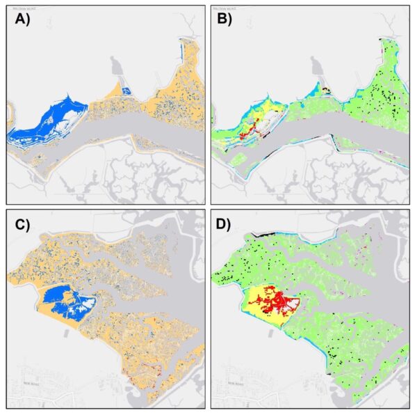
A total of 869.64 ha (37%) can be attributed to gains in managed/unmanaged realignment and regulated tidal exchange sites. The majority of these gains (600.41 ha) can be attributed to the development of new marsh in Steart Marshes (Parrett estuary), Alkborough Flats (Humber estuary), Medmerry (south coast) and Hesketh Out Marsh (Ribble estuary) managed realignment sites.
The largest areas of expansion (positive net change) outside of the realignment and tidal exchange sites were recorded in the Humber (26.2%) and Thames (8.3%). The region with the greatest net loss was South Wessex (-2.5%).
The temporal changes discussed here represent an analysis of the data and not an assessment of why or reasons for change. Further, this report does not assess the quality or condition of saltmarsh and is limited to analysing saltmarsh extent and zonation only.
The inventory provides evidence and insight into changing habitat extent at national, regional, and local scales. It is an intention of the inventory that national scale trends do not misrepresent or mask local trends. Furthermore, gains within one waterbody or region should not be seen as compensation for losses in another waterbody or region.
Further information and the Environment Agency research report can be found here.